Survey-grade drone scanning
Your whole project.
One click away.
Survey-grade drone scans, delivered as an interactive 3D experience in your browser.
Delivery
Your whole project. One click away.
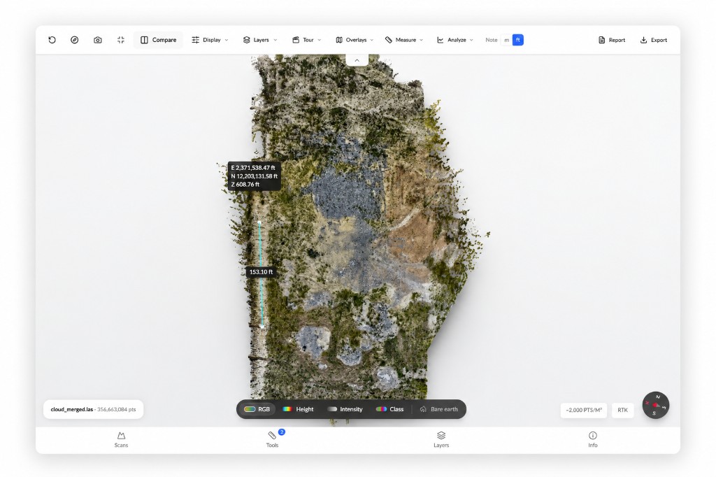
No software. No training. No hundred-gigabyte files. Your team opens a link and flies through a survey-grade 3D model of the property.
Full site overview screenshot
/media/viewer-overview.png · 1024×682
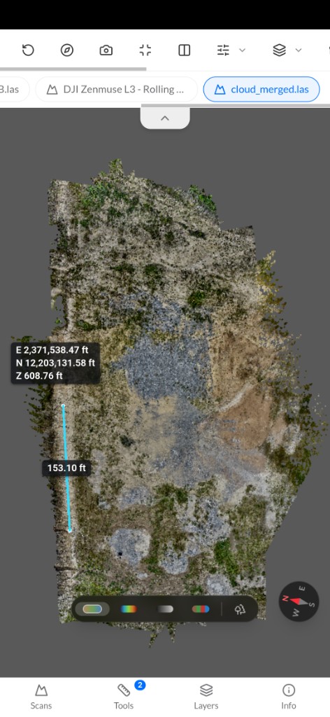
Mobile viewer screenshot
/media/viewer-mobile.png · 472×1024
Nothing to install
Any browser. Any device. Zero training.
Boardroom to job site
The same link works on a phone in the field and a screen in front of clients.
Always the real site
Every scan shows the property as it actually is, not as the plans say it should be.
Capabilities
Your site data, all in one place.
Explore the list of advanced features for your site data here.
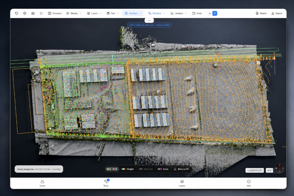
Compare your site data against existing surveys
Overlay CAD drawings onto your real-time site model to compare proposed layouts with surveyed conditions. Import and export DXF, KML, or GeoJSON files directly into the viewer.
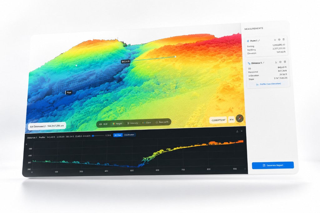
Measurements
Measure distance, height, angles, areas, and volumetrics directly from your scan.
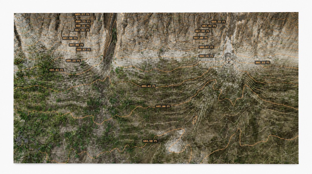
Contours
Survey-grade elevation contours, generated on demand at any interval. Export to CAD, LandXML, or GeoTIFF, the formats your team already works in.
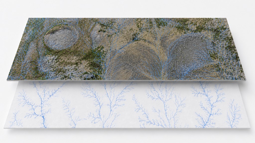
Drainage flow
Adjust rainfall levels to visualize runoff paths and potential pooling areas across your terrain. Identify drainage concerns early, before earthwork begins.
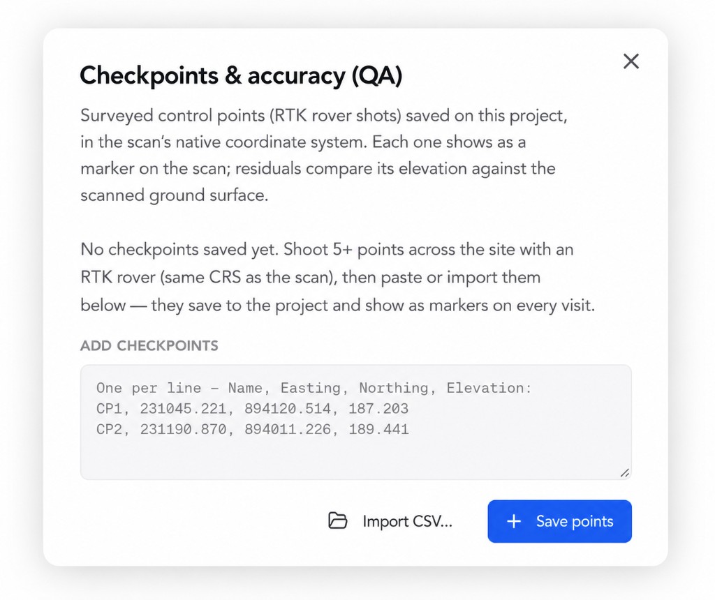
Accuracy you can verify.
Scan accuracy can be verified against independent survey checkpoints, with clear reporting that shows how closely your data matches the real ground conditions.
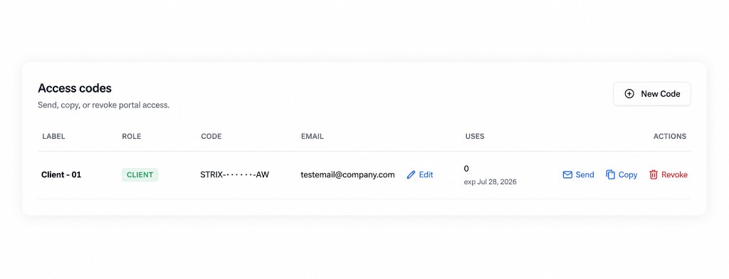
Secure sharing
End to end encryption that allows you to share your site data, manage permissions, and remove access anytime.
How it works
From site capture to interactive model in 3 steps.
We scan your property.
Our licensed pilots capture detailed site data with drone based LiDAR and aerial imagery.
We build your terrain model.
We process your data into an interactive model with measurements, terrain analysis, and exportable data.
You explore and share.
Access your site through a private browser link, explore the data, and share it with your team and engineers.
Industries
Industries we serve.
Construction & earthwork
Track site progress, measure stockpile volumes, and compare topographical maps, water drainage, slope angles, and measurement changes between scans and surveys.
Land development
Evaluate elevations, slopes, potential drainage concerns, topographical mapping, and elevation changes, and place control checkpoints before your next development phase. Share interactive views with engineers, contractors, and project planners.
Waste management & landfills
Track changes in fill volume and material stockpiles, and document how the site contours change over time.
Solar & renewable energy
Assess terrain slopes and elevation changes to support preliminary panel layouts, access roads, and drainage planning.
Trust & security
Your project data,
securely managed.
Encrypted end to end
Your site data is encrypted in transit and at rest, from the drone to the browser.
You control access
View-only links, per-person permissions, revocable anytime. Nothing leaves your control.
Measurement, not photography
LiDAR records distances and elevations, not photographs. Suitable for facilities where cameras are not allowed.